
Capitol Reef National Park, May 22-23, 2013.

My next stop was Capitol Reef National Monument and I really
didn’t know what to expect. The Fruita campground
only had 70 sites, first come first served so that was my first stop and with
good fortune I found a site. When I left a few days later there was a long line
waiting to get in. Fruita campground is named for the fruit orchards
surrounding the campground.

After staking my land grab claim I headed back out to the
Historic Fruita School and Petroglypha. The school was constructed by the
Mormon settlers and was the one room class for 8 to 26 students at any one
time. The building also served as a community meeting place. In 1941 it was
closed due to declining enrollment.

Just
down the road are the Petroglyphas and you can seen in back of the school a
large rock where the students made their own work of art. I am convinced that the human race and an
uncontrollable urge to mark the land with signs of their presence. I observed
so many examples of petroglyphas and graffiti on my journey and all with the
symbols of their times.

This lizard was on guard.

The desks reminded of my own desks in my classes in West
Virginia only we didn’t use the ink wells.


My next stop was a ranger talk at the Petroglyphs of the
Freemont Indians. I have seen other
petroglyphs but these were the most enchanting I saw during my journey.
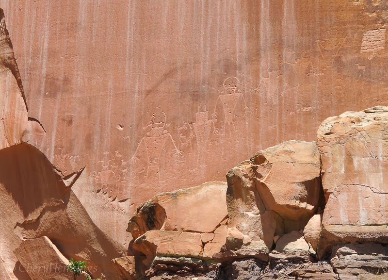
They are created by pecking into the cliff face.

The Fremont Indians are ancestors to various modern tribes
living in the southwest today. They settled here over 1,000 years ago, where
they built home and farmed the land.
These marking are the historical and spiritual legacy of modern Indian
peoples.

While I was observing the art a couple of baby Mule Deer
were observing me.

The ranger passed around a photo of Freemont moccasins (replica)
made from deer. I found it interesting how nothing was wasted as used the deer’s
own leg and foot as a model, perhaps one of the first uses of bioemimicry.


I had lunch at the picnic area and couldn’t resist hugging
these magnificent trees.


Heading back to the campsite I saw my first Yellow Bellied
Marmot.

The next day I took the Scenic Drive in search of a good
view of the Waterpocket Fold preserved by the park. It is a buckle in the Earth’s
crust created 65 million years ago. I was not able to get the spectacular photo
I wanted but I did manage to take a photo on a small piece of the edge of the
fold.

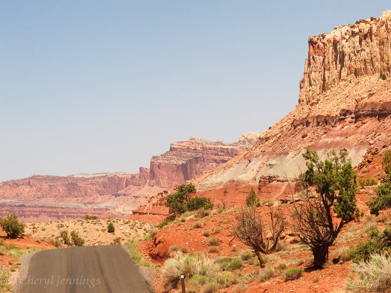
The Navajos call the area “The Land of the Sleeping Rainbows.” The pallet of colors was similar to Death
Valley.


My drive ended at Capitol Gorge. Here I wished I had a horse or 4 wheel drive
so I could continue on. So much of this
area cannot be seen from campers or regular cars but what I did see was
magnificent.

Sure I could have hiked the 2 mile round trip but frankly I was
just plain ole tuckered out.


Leaving the park the following day I stopped by the Behunin
Cabin build and settled in 1882 by Elijah Cutler Behunin and his family of 10.

The parents and the two smallest children slept in the cabin. The post bed
almost filled one side of the room. By widening a dugout in the cliff, the
older boys had a place to sleep and the girls made a bed in an old wagon box.

They ate outdoors. I think my camper is about the same size
as the cabin. Eventually they left when the river washout out their crops.

When I left, I drown onto Greenriver Campground where I took time out from my big adventure. The drive was another beautiful experience.


+DSCN5800+for+blog.jpg)


1 comment:
That's an amazing landscape! And amazing photos! And nice trees to hug too.
Post a Comment