Showing posts with label Native People. Show all posts

Monday, March 24, 2014

Madison Buffalo Jump

23 June 2013

There are several Buffalo Jumps in Montana but Madison Buffalo Jump was more or less on the way to Glacier my next National Park. A buffalo jump is a high ledge that the western native people used to help harvest buffalo for the winter.


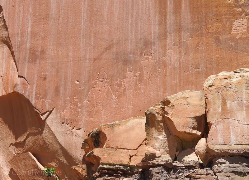
This cliff was an important hunting tool used for communal bison hunting. Sosoni' speaking (Shoshone) probably used the jump most frequently, but over time many nations have call this area home. For days the entire camp plans and prepares for the upcoming hunt. Tools, weapons and hearths are ready. Ceremonies and personal rituals are performed. Many of the artifact such as arrow and spear heads, and pottery shards were found in the area.


Runners locate the heard and with their bodies covered in wolf skins they crouch and began to move the heard toward the cliff. After witnessing a buffalo drive in 1776, fur trader Alexander Haney wrote, "The Indians' gestures so closely resemble those of the animals that if I had not been in the secret, I would have been as deceived as the buffalo." As they move the heard onto the plateau, hazers hiding behind rocks jump up and begin shouting and waving hide.  Below all eyes are fixed on the cliff ready for the stampede of bison of to fall to their death. Those below others move in to kill any injured animals.


Below the 30 foot cliff women began butchering and skinning the bison into manageable pieces. The large bones were cracked open and boiled to remove the nourishing marrow. Nothing was wasted. I think my camper was parked in one of the butchering sites. The majority of the meat was preserved for winter food. Long strips of meat were hung from pole racks to dry. Once dry, the meat was ground into small bits, mixed with the marrow and often chokecherries, buffalo berries or other fruits dried in the summer. The mixture was then spread out in sheets to dry and then cut into cakes. These energy bars, called pemmican, provided nourishment throughout the winter.

While I was there a park ranger came up the trail and told me the history of the area and offered suggestions for other places to visit while in the area. Besides a man and his son I was the only other person around and they soon left leaving the place to myself. 


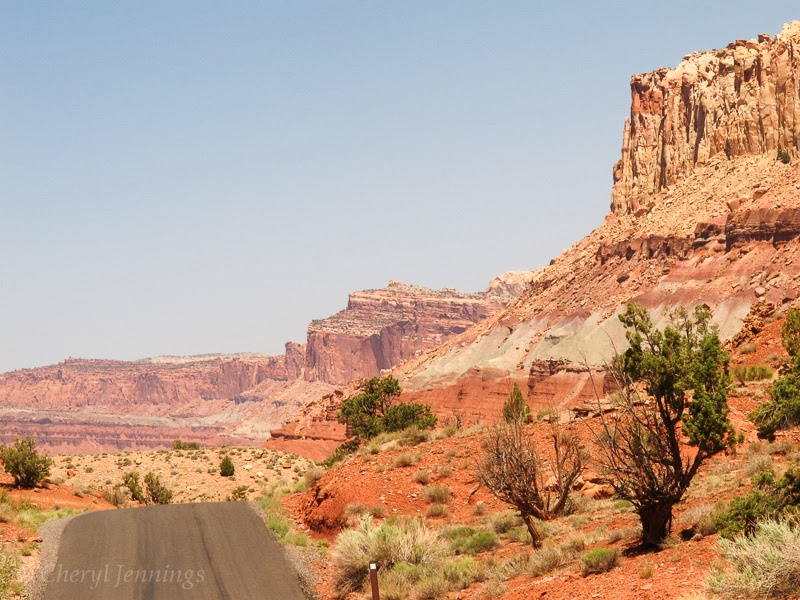
As I slowly drove back along the gravel road I noticed these cloud formations. I started to think that this was the place where photos were taken of clouds to study in textbooks. There was so much sky and the clouds kept changing.


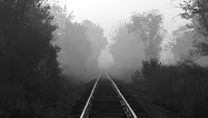
Later I wrote in my journal: "I could see forever and what I saw was rolling hills of grass, foothills sage green with that wonderful smell of herb and blue mountains and snow covered peaks. Occasionally cattle dotted the landscape but they could have just as easily been buffalo.  I felt like it had always been this way but now instead of wagon ruts there was a 2 lane road.


"There is more than what you see here." -- Tony Icashula, Pend d'Oreille

Wednesday, January 22, 2014

Dinosaur National Monument Day 2

May 31, 2013

The next morning I drove down Cub Creek Road to see the Fremont Petroglyphs. Approximately a thousand years ago (500-1300AD), the Fremont people settled in this area as evidenced by the petroglyphs chipped into the rocks. They gathered and ate native plants, and hunted mule deer, bighorn sheep, small mammals and birds. The Fremont also farmed corn, beans and squash.


Hammer stones were used to chip and carve these images. Sandstone darkened with desert varnish, a naturally formed stain of iron and manganese oxides, I mentioned in a previous blog, made an ideal canvas for their carvings.


I think they rival any modern day art. The classic Fremont style features trapezoidal shaped anthropomorphs (human like figures) with borad shoulders, and narrow waists.  Often these figures are adorned with intricate necklaces, ear bobs and head dresses.


On down the road I came to a larger and higher petroglyph site and began climbing. On the way up I spotted these two lizards mating.  


They didn't even notice me and I had time to pull out another camera and take this video.


Just up the trail were several  images of lizards and I wondered if this was a sacred spot for lizards who come here annually to revel in sexual rituals to appease the great lizard gods and  assure themselves of healthy offspring and abundance of insects for the coming year. I love to anthropomorphize.


Zoomorphs (animal like figures) and geometric designs are also common subjects of the Fremont rock art.
There were many more images along this ridge including the flute player. 


No one really knows why these are here; some say for ceremonial or religious purpose. Or they could be related to hunting activities, identifying their clans or simply expressions of artist’s imaginations. Even today don’t we, in developed countries, create similar art, graffiti, religious art in churches, great mountain carvings? It seems there is a human need to make our mark upon the earth that goes back thousands of years.


These images were pretty high and I took the opportunity to take a photo of my camper and surrounding landscape. It was so peaceful up there, with only bird song in my ears, it was the ideal place to draw and write.


At the end of the road was Josie Mosses’ homestead where she lived in the early 1900’s. She was quite the character. Nearing 40 years of age, divorced and with her children out of the house she wanted a home of her own. Josie chose this spot for its plentiful water and good pasture, the natural resources necessary to grow fruits and vegetables and raise cattle.


Family and friends from Vernal visited but here life here suited Josie’s independent spirit. She lived in this cabin until shortly before her death in 1964 at age 90. I was in high school at the time and Beetles had just arrived in the US. She had no plumbing or electricity but she did have gumption.


Tuesday, January 21, 2014

Dinosaur National Monument

Dinosaur National Monument – May 30, 31, 2013

My next destination took me east on I-70 into Colorado, north on State Routes 139 and 64, then US 40 up to Dinosaur National Monument.  Many of the routes I took on my Big Adventure were like visiting a national park and Route 139 was such a route.  There were no businesses or homes, just me and the road and beautiful scenery.  It was 80 miles of gorgeous.  Walt Whitman’s words from “Song for the open road” some to mind: “Afoot and light-hearted, I take to the open road, healthy, free, the world before men the long brown path before me, leading wherever I choose.”  I was just one of those kinds of days and to stop and take a photo seemed like it would take the magic away.

So onto Dinosaur National Monument I drove and finally stopped at the Green River Campground.  You can see the camp sites below and how close I was to the river.  


Once I marked my site I drove back up to the Visitor Center and was greeted by this dinosaur. 


Inside the visitor center I learned how that they called this a landscape of extinct ecosystems represented in 23 of the geological formations exposed here.  I wish I had studied up more on my geology but frankly I find it so hard to grasp these geologic times.  Rather than take the bus up to the Quarry Exhibit Hall I hiked the fossil discovery trail which led pass this formation. The clouds rolled in fast but the went on anyway.


I found a few desert flowers and...


... came upon some of the Freemont Petroglyphs scattered about the park.


More flowers, like the Sego Lily (Calochortus nuttallii).


I stopped briefly at the Mowry Shale containing fish scale fossils but I didn’t have any luck finding the fossils.
 

No matter, the flowers were enjoyable.


I began climbing and could see the Green River in the far distant.


Up ahead was the Quarry Exhibit Hall.

The wall of bones inside was amazing.  Earl Douglass found eight tall bones of an immense sauropod dinosaur sticking out of the ground in 1909. He was a paleontologist from the Carnegie Museum in Pittsburg, Pennsylvania.

Paleontologist have collected fossils from almost 400 different dinosaurs. There are 1,500 fossil bones remaining. They are from 100 individuals.


Unlike most museums, here I could touch one of the bones.


Allosaurus Skull and other cool ones.


Driving back down to the campsite I passed this formation and dig site.


That evening I was treated with a beautiful sunset over the Green River.


As I looked closer I saw a small heard of mule deer climbing up to cross over the ridge. Here they are still in the grass and you can spot their white butts.


"If future generations are to remember us with gratitude rather than contempt, we must leave them more than the miracles of technology. We must leave them a glimpse of the world as it was in the beginning, not just after we got through with it.” – President Lyndon B. Johnson

Tuesday, January 14, 2014

Capitol Reef National Park

Capitol Reef National Park, May 22-23, 2013.


My next stop was Capitol Reef National Monument and I really didn’t know what to expect.  The Fruita campground only had 70 sites, first come first served so that was my first stop and with good fortune I found a site. When I left a few days later there was a long line waiting to get in. Fruita campground is named for the fruit orchards surrounding the campground.


After staking my land grab claim I headed back out to the Historic Fruita School and Petroglypha. The school was constructed by the Mormon settlers and was the one room class for 8 to 26 students at any one time. The building also served as a community meeting place. In 1941 it was closed due to declining enrollment.  

Just down the road are the Petroglyphas and you can seen in back of the school a large rock where the students made their own work of art.  I am convinced that the human race and an uncontrollable urge to mark the land with signs of their presence. I observed so many examples of petroglyphas and graffiti on my journey and all with the symbols of their times.


This lizard was on guard.


The desks reminded of my own desks in my classes in West Virginia only we didn’t use the ink wells.


My next stop was a ranger talk at the Petroglyphs of the Freemont Indians.  I have seen other petroglyphs but these were the most enchanting I saw during my journey.


They are created by pecking into the cliff face.  


The Fremont Indians are ancestors to various modern tribes living in the southwest today. They settled here over 1,000 years ago, where they built home and farmed the land.  These marking are the historical and spiritual legacy of modern Indian peoples.


While I was observing the art a couple of baby Mule Deer were observing me.


The ranger passed around a photo of Freemont moccasins (replica) made from deer. I found it interesting how nothing was wasted as used the deer’s own leg and foot as a model, perhaps one of the first uses of bioemimicry.


I had lunch at the picnic area and couldn’t resist hugging these magnificent trees.


Heading back to the campsite I saw my first Yellow Bellied Marmot.


The next day I took the Scenic Drive in search of a good view of the Waterpocket Fold preserved by the park. It is a buckle in the Earth’s crust created 65 million years ago. I was not able to get the spectacular photo I wanted but I did manage to take a photo on a small piece of the edge of the fold.


The Navajos call the area “The Land of the Sleeping Rainbows.”  The pallet of colors was similar to Death Valley.


My drive ended at Capitol Gorge.  Here I wished I had a horse or 4 wheel drive so I could continue on.  So much of this area cannot be seen from campers or regular cars but what I did see was magnificent. 


Sure I could have hiked the 2 mile round trip but frankly I was just plain ole tuckered out.


Leaving the park the following day I stopped by the Behunin Cabin build and settled in 1882 by Elijah Cutler Behunin and his family of 10. 


The parents and the two smallest children slept in the cabin. The post bed almost filled one side of the room. By widening a dugout in the cliff, the older boys had a place to sleep and the girls made a bed in an old wagon box.


They ate outdoors. I think my camper is about the same size as the cabin. Eventually they left when the river washout out their crops.


When I left, I drown onto Greenriver Campground where I took time out from my big adventure. The drive was another beautiful experience.